iwastoldicouldlistentoweatherreportsatareasonablevolumefromthehoursofninethirtytoeleven
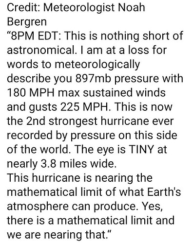
The one positive to this explosive intensification (third most rapid intensification cycle in history after Wilma (2005) and Felix (2007)) is that, when storms reach this intensity, they undergo periodic eyewall replacements. So, as we move forward in time, it is likely that the storm will do so and lose considerable intensity. On the flip side, storms get much larger when that happens so the impact area in FLA will be much larger.
From 90mph to 160mph in 10 hours. Time sensitive loop:
If you have a fast connection and a high rez monitor, here is Milton going from 125 to 175mph in a 400 frame loop at 1 minute intervals at 1km resolution. Wow.
Interesting, didn’t realize there was a limit. Can Das provide an explanation for the layman?
It’s all physics based regarding the exchange of heat. Available heat contained in the ocean and it’s ability to transport up to the atmosphere create those limits. The warmer the Ocean, the more available energy. The colder the upper atmosphere, the greater that delta and available latent heat release. The calmer the atmosphere (no shear) that allow for the effective transfer of that heat, the smoother and more effective the process. These are the basic parameters. What that guy is saying, with his breathless take, is that given the current set of parameters, this is about as strong as the storm can get.
Sorry for the tortured English. I am doing voice to text in between meetings. Back to work for me…
I thought he said layman.
“Oh stewardess! I speak jive…”
Boarded up the house as tight as we could get it and took off this morning. We only went to Orlando, which we know will also get hit but this property is much more of a fortress than our 1941 bungalow 3 blocks from the Hillsborough river. We just didn’t want to be too far from home for whatever aftermath we’re facing.
Hang in there. We’re all thinking of you
Thinking of you, Ty. Be safe.
I hope you and your family stay safe, Ty.
I’m glad you’ve moved out of Tampa. This thing seems to be making its way to the coast excruciatingly slowly. It would be hell to be sitting there waiting on it.
I imagine the wind and rain will play hell with Orlando but at least no storm surge. Stay safe Ty.
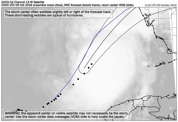
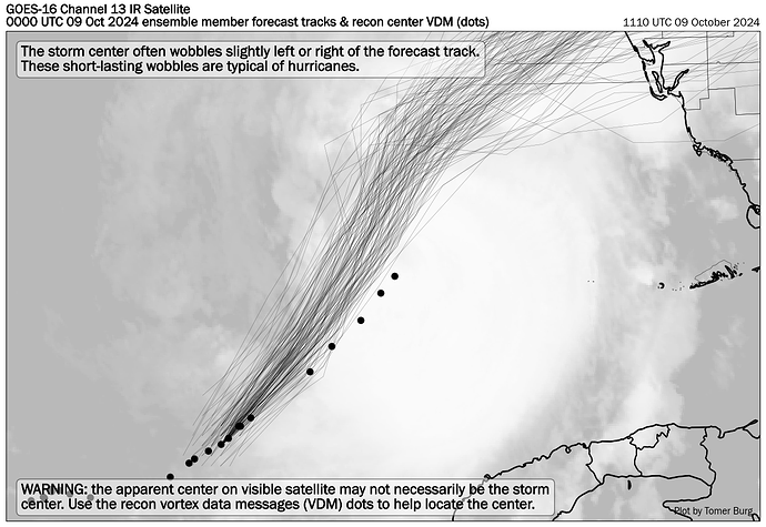
@Ty_in_Tampa, Five straight position fixes to the right of the official forecast track.
Better for Tampa, worse for Sarasota and Fort Myers. We will see if this is just a wobble or an actual southward shift.
Thanks, das! I’ve been watching that creep from the official NHC graphic for the last few advisories. Any shifting that direction makes a big difference. Can only hope for the best.
Awful anyway, but especially so:
ETA: Apparently it was mostly empty tonight but was intended to be a staging area for prep and cleanup. The latter purpose is obviously impacted.
In a weird coincidence the Tropicana hotel in Vegas was also imploded today


